Bula!
We are in Fiji, friendly locals and thank god things are cheap!
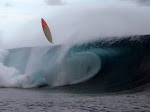
That area with the wave is truly awesome, long perfect left, long perfect right, lots of other nooks and crannies etc etc. Good anchorage on that narrow sandbank on the inside of the lagoon near the left. BUT, this all went to shit went the SE trades came up again yesterday. Sandbar anchorage became untenable, had to go back to a so-so anchorage about 5 miles west, on the SE corner of Taveuni Island. Yesterday afternoon Kahlil, Josh and myself went into the local village on Taveuni to do a sevu-sevu ceromony (google it) which is how you ask for permission to anchor. This entails being introduced to the village chief, handing him a bundle of Kava root (which we had pre-bought in Savusavu). If he accepts the Kava (which they usually do), then your are "accepted" to the area and may anchor, surf etc etc. All went down well with our sevu-sevu except that they cooked and ate Kahlil.
This is now our 2nd day of strong 20 knot ESE winds... the whole south facing area is completely blown out, so we headed around the north west side of Taveuni, we are now anchored in the lee of Taveuni, about 2hrs drive from the surf zone, waiting for the wind to calm down. However, there is a strong NNE wind predicted for tomorrow and the next day... so our current anchorage might become onshore ... but then again a NNE wind will be offshore on the left... but may be too strong ... blahblahblah. Bottom line is that this may be wrong time of year for this area, which has a narrow swell window (swell needs to squeeze past the Lau group) AND its onshore with the May-Aug SE trades. Either way, it takes a while to get to know an area, especially this one, as our charts are dodgy. Two days ago we spent the morning buzzing around on the dingy, with handheld GPS and chart, marking all the true positions (lat and long) of the reefs onto the chart, diving down to check depths etc, like doing a crude but effective survey. Followed by transferring all the data onto shimmi's chart plotter. Only once this was done was I confident enough to drive shimmi "into" the area.
This has been a true modern surf exploration, starting with Kahlil finding these "potentials waves" on Google Earth, then a long stormy crossing to get here, then checking in and stocking up at Savusavu, then heading back up to the surf area, hoping to coincide with a swell and favourable winds, then struggling to find a good anchorage amongst unmarked reefs and a setting sun, then the next day doing our own dingy survey, then finding a suitable anchorage near a surfable wave... to finally surfing it small, only to have a murderous SE to blow it all to shit the next day... but who knows? Hold thumbs for a few glassy days with a nice south swell.
To put this all into perspective, other than Chantal and Kahlil's session 2 days ago on the lefthander, we have not surfed since leaving Huahine more than a month and a half ago, and now it looks like this Taveuni area may be a hard nut to crack at the height of the SE trades. And that is the reality of exploring for surf, and it is why most surfer-cruisers just head to the known spots. Fiji does have plenty of other west facing reef pass waves which are offshore on the trades, so no major worries, its only a matter of time before we are in the green room once again.
Our permits to visit the Lau group looks like they may happen. Google the Lau Islands, they are part of Fiji, but only just. You cant go there without applying for all sorts of permits, it is a truly primitive, unspoilt island group, and its got sick surf with no-one on it. The southern Laus have great swell exposure and some great SW facing reef passes. Check them out.
Bula!
G
Chantal and Golla Malherbe Plus their two sons, Josh (four+) and Indie (one+) Following their dream on board their Fontaine Pajot 45ft Catamaran SY "Shimmi".
YOUR SURF HOLIDAY
For your next surf holiday
Contact Lorrin at
All Aboard Travel:
all-aboard@vodamail.co.za
www.all-aboardtravel.com


